The Mountains are Calling and I Must Go - Big South Fork, May 2021
- Emily Lubbers
- May 25, 2021
- 13 min read
Updated: Oct 26, 2022
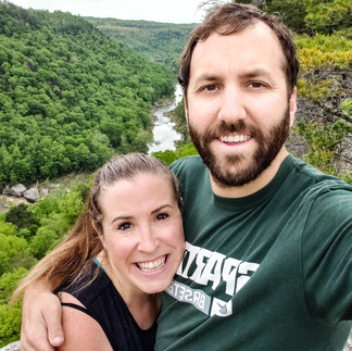
John Muir once said "The Mountains are Calling and I Must Go". After a rough couple weeks, or months really, this is exactly how Corey and I felt. We desperately needed a weekend away to relax and reconnect with each other, and with nature. We decided to take a last minute weekend trip. Given our location, we are limited to Ohio, Michigan, Indiana, Kentucky and northern Tennessee for reasonable destinations for a weekend trip. We already have two weekend trips in June planned for Indiana, and Michigan still feels a bit too cold this time of year. We settled on checking out Big South Fork National River and Recreation Area on the border of Kentucky/Tennessee.

Big South Fork NRRA is part of the National Park Service and encompasses 125,000 acres of area in the Cumberland Plateau region. The park is characterized by a river gorge where Clear Fork and New River converge to form the Big South Fork of the Cumberland River. In the early to mid-1900s the area drew several mining and timber companies. The town of Blue Heron was formed in association with a mine, called Mine 18. Both were abandoned in 1962. In 1989 Blue Heron Mining Company took over and operated Mine 18 with Blue Heron as a semi-restored ghost town. In 1991 the area was turned over by The Corps to the National Park Service on it's 75th anniversary. Today the park is popular for camping, hiking, horseback riding, mountain biking and whitewater rafting.
With the destination selected, it was time to move on to lodging! There weren't a ton of options since we were booking so last minute, but I got lucky and found the cutest cabin in Oneida, Tennessee on Airbnb, called Ranger Retreat. It was a small one bedroom cabin with a loft that allowed dogs and is only about 20 minutes from Big South Fork and 3 1/2 hours from Cincinnati.
I was able to leave work early on Friday and we hit the road around 3pm. Once we were out of Cincinnati traffic, the drive was very smooth. The cabin was easy to find and we arrived around 6:30pm (though I could see the cabin being difficult to find for the first time in the dark). After unpacking the car we started looking for a short hike we could do before the sun set.

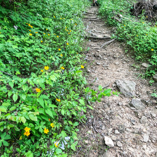
We were able to find a popular hike, Split Bow Arch, that was only 25 minutes away and under a mile in length. There are two access points for the arch; the trailhead and the overlook. The trailhead is located at Bear Creek Overlook parking lot. The overlook is 1/4 mile further down the road and has a small pull off for parking. We did not realize the trailhead was at a different location than the overlook and parked at the overlook, as this is where the GPS directed us. From the trailhead, an out and back trail to the arch is .3 miles in each direction. You can also complete a loop at .7 miles.
The overlook is simply that, an overlook viewing the top of the arch. There is technically no trailhead access here and a sign saying "Danger Do Not Walk on Arch" is posted on the guardrail. The view from the top of the arch was okay, but we wanted to see it from the bottom. We could see a trail on the other side of the arch so we disobeyed the sign (whoops) and shimmied around the fence and over the arch. From the other side of the arch we were able to pick up the end of the trail. After checking out the arch we decided to take the trail back to the Bear Creek parking lot. I believe the trail is considered 'moderate' as it was somewhat hilly, but with it's short length it is definitely on the easier side.


We had a bit more time before the sun was going to set and decided to check out Bear Creek Overlook as well. This hike is a .5 mile (each direction) out and back trail to a deck overlooking the gorge and river. I am so glad we decided to hike to the overlook because it was STUNNING, especially as the sun was getting setting. The trail is basically flat and meanders through the woods until it opens up at a wood deck where you have a panoramic view of Big South Fork. The gorge amplifies the sound of the rushing water so from the overlook you could actually hear rapids flowing nearby, even though we could not see them. Also, because of how high the overlook is, the hawks circling for their dinner were basically at eye height with us and kept flying by, almost within reach. I highly recommend checking out these two quick hikes as the views were some of my favorite of the trip.
When we had about 20 minutes left before the sun set we hiked back to the parking lot and then walked along the road back to our car. Back at the cabin I made dinner while Corey got a fire started in the pit outside. We spent the evening drinking a couple beers and relaxing by the fire. The cabin even had a dog bed for Nova, which she hilariously did not know what to do with at first.

The owner of the cabin used to be a park ranger for Big South Fork so I asked him for hiking recommendations. He recommended three different trails. We decided to check out his top recommendation, Angel Falls Overlook, to start our Saturday. We ended up getting a bit of a late start, as we stayed up pretty late the night before. We made breakfast, packed our bag with food and supplies for the day, and then hit the road. Angel Falls Overlook is about 30 minutes away from Oneida.
Accessing the trailhead for Angel Falls Overlook is a bit confusing. There are two trails; Angel Falls and Angel Falls Overlook, that start at the same parking lot, but are very different trails. Angel Falls is an 'easy' 2 mile out and back (4 miles total) trail along the river. Angel Falls Overlook is a 'moderate/strenuous' 3 mile out and back (6 miles total) trail that hikes up the gorge to an overlook of Angel Falls (which are actually just rapids). Both trails have trailheads at the Leatherwood parking lot.

To add to the confusion, there is no signage indicating the trailhead for Angel Falls Overlook at the Leatherwood parking lot, only Angel Falls. When you first pull into the parking lot there is a sign that tells you to go left for Leatherwood and right for Angel Falls, nothing indicating where the Angel Falls Overlook is. To access Angel Falls Overlook you go left and park on the Leatherwood side of the lot. The parking lot is located along the river bank. The trailhead is actually on the opposite side of the river and you have to hike back up to the main road and walk across the vehicular bridge in order to access it. Once on the opposite side of the river there is a sign indicating the trailhead.
At first we had no idea where we were going, other than that the ranger had told me the trailhead was at this parking lot. Unfortunately, I had forgotten the map I had printed at the cabin, and as soon as we got into the park we lost cell service. Thankfully, I knew from my research that we did not want Angel Falls trail, or we probably would have taken the wrong hike. After wandering around and talking to a couple different people, a very nice couple pointed us in the correct direction. Apparently the trailhead used to be the same side as the parking lot, but a flood a couple months back took out the pedestrian bridge that crossed the river, so now you had to cross the road to access the trailhead.

The main reason the trail is considered strenuous is because of it's length rather than it's overall difficulty. Almost the entire trail follows a portion of the John Muir National Recreation Trail (not to be confused with John Muir Trail in California). This portion of JMT is also a portion of the Sheltowee Trace National Recreation Trail. John Muir NRT is a 21 mile trail that extends the full length of the Tennessee portion of the park. It is said to follow the same path John Muir historically took while traveling from Kentucky to Tennessee. Sheltowee Trace NRT is a 319 mile trail that spans both Daniel Boone National Forest and Big South Fork NRRA. Almost the entire trail had blue JMT blazes that clearly marked the path.
The first 2 miles of the trail are relatively flat and stick close to the river bank. There are a couple creek crossings and downed logs to climb over, but overall the trail is easy. There were a couple spots where it was evident how high the flooding had been. It was pretty crazy to see!
About 2 miles in we ran into a bit of an obstacle where there used to be a scenic foot bridge crossing the Fall Branch creek. This bridge was also wiped out by the floods and is currently impassable. The trail is blocked with caution tape and a detour sign, though the path of detour is not overly clear. We ended up walking along the creek bank for a short bit unsure of where to go before we noticed a trail on the opposite side of the river with a tree marked with a red cloth. You have to make your way down the river bank and then rock hop across the creek to the opposite side and then back up the river bank. We were able to do this relatively easily with our water proof hiking boots, but I've heard the path is impassable after heavy rainfalls/flooding.


Almost the full 600 foot climb happens in the last mile before the overlook. Once across the water, you turn away from the river and start to climb the gorge. While this part of the trail is more difficult, it is also beautiful. Before you make it to the overlook there are rock formations and overhangs, a narrow canyon, a small rock scramble with a safety line, and a small ladder climb. We took a couple wrong turns, but never made it far off the trail each time before we realized we needed to turn back. At one point we dropped down a small rock cliff that involved carrying Nova a bit (thanks Corey!) before quickly realizing we needed to turn around. On our way back to the trail we saw a large (around 3') snake that we had walked right past. Thankfully Nova didn't notice and we were quickly back on our way without much commotion. At 2.8 miles you meet a fork where JMT and Sheltowee Trace separate from the Angel Falls Overlook trail. The fork is clearly marked. The final .2 miles is level and takes you to the flat rock that makes up the overlook.

The overlook itself is a large flat rock where you can spread out and take in the view. We had the spot to ourselves the majority of the time. There was a tree we were able to tie Nova to so we could safely relax and enjoy the scenery. And let me tell you, the scenery was absolutely incredible. Of all the trails we did at Big South Fork, this was hands down my favorite and I am so happy that we took it on. I highly recommend it!


The hike back down went quickly and easily. Throughout our entire time on the trail we saw maybe 10 other people, which was crazy considering it was a beautiful day in May. For most of the trail we felt like we were in our own little world. It was such a relaxing and invigorating experience.

It took us a little over 3 hours to complete the entire hike. With our late start and how spread out the park is, we only had time for one more short hike before it got too dark. I found a list of popular hikes in Big South Fork on Laurel Fork Rustic Retreat's (a local cabin rental company) website. We decided on hiking the Gentleman's Swimming Hole trail. Per the website's description, this hike was to include Clear Fork River, wildflowers, interesting cliffs and boulders, and a historic cemetery. The trailhead is located at the historic Laurel Dale cemetery in Historic Rugby, Tennessee, about 30 minutes from the Leatherwood Parking Lot, where we were currently located.
I'll be honest, we had never heard of historic Rugby, Tennessee before. Upon arriving we discovered it to be a quaint Victorian era community that looked to be straight out of the the early 1900s. Of course I had to google to find out the history. Rugby, Tennessee is a community that was originally founded in 1880 by British author, Thomas Hughes. It was intended to be a 'utopian colony' designed to focus on Christian socialist ideals rather than materialism. Though the community largely failed, there was a small population that remained throughout the 20th century. Now the area is preserved by a non-profit that is slowly restoring the historic buildings back to their original charm. There were several different shops and restaurants in the downtown area, and the surrounding houses and cottages were all designed in the Victorian style. Unfortunately, I assuming due to COVID-19, the area was a ghost town. Everything was closed.
Right in downtown Rugby is the Laurel Dale Cemetery, where the trailhead for Gentleman's Swimming Hole is located. We wandered around the cemetery for a couple minutes before starting out on the trail. The trail directly to Gentleman's Swimming Hole - named for the spot in Clear Fork River where the men of Rugby would swim - is .4 miles in one direction. A 2.3 mile loop trail called Meeting of the Waters can also be accessed from the same trailhead.

The hike is a relatively easy trail that leads you down into Clear Fork River gorge towards the river. Right before reaching the water the trail forks. We headed left (right takes you to the loop) to the swimming hole and decided to take a break to eat our picnic lunch. The swimming hole itself was not all that overwhelming. To be honest, I was a little disappointed once we first got there. After eating our lunch we decided to continue on and complete the loop trail. I am so happy we did.

While the hike to, and views of, Gentleman's Swimming Hole were underwhelming, the Meeting of the Waters trail was stunning. This trail gets it's name for the viewpoint where the Great Oak Creek and Clear Fork River meet. Once you make the turn onto the loop trail from the Gentleman's Swimming Hole trail, you continue for about a mile along a narrow strip between the river on your left and the gorge cliffs on your right. The path is relatively easy and flat and includes river views, moss covered cliffs and overhangs, and dense vegetation. There is no marker for the actual meeting of the waters and it would be easy to miss if you not looking for it.

Once you pass the meeting of the waters, the trail quickly climbs the gorge and leads back to the cemetery via an old wagon road. As you climb the gorge the scenery quickly changes from moss covered cliffs and rocks to serene forest views. The final mile through the forest is basically flat. By the time we reached the cemetery we were on mile 8 or 9 for the day and were pleasantly exhausted. Even Nova was starting to wear out! Before making the trip back to Oneida, we drove through some more of Rugby, taking in all the Victorian architecture.
We stopped by the cabin to drop off Nova and change clothes and then head into town for dinner. We had packed food to make dinner at the cabin, but in my hurry to pack, I missed some key ingredients so we decided to eat out instead. We were hoping for bbq but the only bbq place in the area was closed (assuming due to COVID). We stopped at a local pub and grill, Murf's Gearbox Grill, instead for some pulled pork sandwiches and cold beers. This was definitely the hopping place to be and the food was delicious and affordably priced. We both tried out some Tennessee beers before heading back to the cabin to settle in for the night.
On Sunday morning we woke up, ate breakfast, and then packed up the cabin. While we were originally hoping to do two different hikes on Sunday, but decided on one instead, as we were both a bit sore from the day before. We picked a hike on the Northern side of the park in Kentucky so it would be on our way home.
We settled on the Yahoo Falls loop trail and added the Yahoo Arch out and back trail, for a total of 2.6 miles. Yahoo Falls is one of the most popular trails in Big South Fork, but also one of the more controversial. People who go after large rainfalls or in the Spring love it, while those who go during dry spells or during the summer/fall find it to be disappointing. This is because the waterfall becomes nothing more than a trickle during dry seasons. Thankfully with it being early May, and after a large rainfall, we were confident the waterfall would be flowing nicely.
At 113 feet, Yahoo Falls is the tallest waterfall in Kentucky. The primary loop trail for Yahoo Falls is 1.0 miles. There are several side trails and different viewing areas that can make the trail slightly longer. Yahoo Arch is an additional .8 mile out and back (1.6 miles total) trail. These trails are clearly marked, which is great. The road leads into the parking lot for the area. There are several private picnic spots each accessible off their own short trail. The trailhead is at the very back of the parking area, adjacent to the restrooms.

There is a stem trail (an out and back trail from the trailhead that leads to the loop trail) that gets you to the loop trail. Once you reach the loop there are two options. Option one (to the left) utilizes a large set of steep metal stairs to get you down to the waterfall. Option two is a gradual incline. If you go with option one, you will hit the waterfall and then continue to the out and back Yahoo Arch trail, before completing the loop. Option two takes you to the out and back trail and then you finish with Yahoo Falls. We opted for option one and decided to climb down the large metal stairs and up the gradual incline.

The metal stairs are no joke and we actually passed a couple carrying their dog because it was too scared to go up them itself. Once at the bottom of the stairs, the rest of the trail is relatively easy. Once you get to the waterfall there is a set of stairs that takes you to the base of the waterfall. We hiked down to the base and let Nova enjoy a drink of water before continuing on. The trail then continues behind the waterfall.

I am glad we did Yahoo Falls, as it was beautiful. I am also glad we added the Yahoo Arch out and back to make the hike a little more substantial and challenging. However, Yahoo Arch itself, was nothing to write home about. The hike to the arch was moderate in difficulty -with some a gradual climb via switchbacks - and beautifully peaceful as we only passed one other group of people the entire time we were hiking it. It is deep in the forest and after the rain we'd had, everything was so green and beautiful.

Overall we spent about 1 1/2 hours checking out Yahoo Falls and Arch. Once we made it back to the car we loaded up and hit the road to head home. It was beautiful our entire hike, but about 20 minutes after we hit the road it started raining very hard! I would much rather drive thru than hike thru rain, so it worked out well!
All in all it was such a great weekend. It was an amazing time to reconnect and spend some quality time with Corey. The weather was perfect and the scenery was amazing. I definitely think we will go back to Big South Fork to check out the trails we didn't get to on this visit. For Memorial Day weekend we are taking a trip to the Lexington area. We also hope to plan something bigger for this summer. AND I still need to post all about our Puerto Rico trip from February! Check back soon and check out some more pictures from our trip below!


Comments